If you are using the C2C map or guide book, you may be a little confused when you arrive in Lorton on the way to Whinlatter: the signs on the ground have been changed to show a different route up Whinlatter Pass.
You arrive in Lorton village at a crossroads; the map, guide book and signs all tell you to turn right and after a couple of hundred yards to go straight over another crossroads. So far so good.

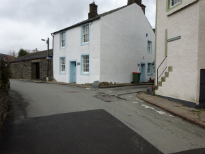
Then you come to Lorton Village Shop, brand new and a brilliant addition for the C2Cer, immediately before Whinlatter Pass.
As well as offering teas, coffees and food, they also have bike parking in their garden and a tap to top up your water bottle before the climb ahead.
These are their opening times, and you can go to the Lorton Village Shop Facebook page here to find out more.
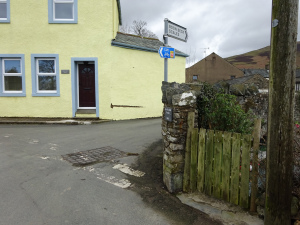
Immediately after the Shop comes the alteration though. You arrive at a sharp left bend and the C2C sign points you that way, while the map or guide book tell you to take a small right turn.

They both end up at Whinlatter Visitor Centre at the top of the Pass, but they take quite different routes, each with advantages and disadvantages.
- The Signposted Route.
After going round the left-hand bend, in about 20 yards, there is a small sign pointing you right.
That leads into the start of the hill, and after about half a mile brings you to a T-junction with the main road up Whinlatter Pass.
Go right, and the road now meanders up the valley, alternatively steep and flatter, steep and flatter.
The steepest section comes after a sharp right hand turn over a bridge. The road then twists left and steeply, and again left and steeply. Be very careful of potholes just here, and of cars coming downhill around blind bends or cars overtaking you on the way up.
After the double left-hand steep bends the route returns to more gentle climbing.
Advantage of the route:
- signposted
- less steep than the other route overall
Disadvantage of the route:
- more traffic, especially if you are cycling the C2C on a busy weekend, especially bank holidays
2. The Map and Guide Book Route
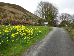
This is the original route, and it may be that those changing the signposts did so because the route had become very potholed. However, those have now been filled, and the worst sections re-tarmac’d altogether after the December 2015 floods had turned this into a river. The surface is now pretty good.
At the sharp left bend, just by a little gate into the pretty village hall garden by a stream, take the small right-hand turn.
Almost immediately the road swings a sharp left and starts to climb. This first section is quite steep, but has been completely re-tarmac’d.
The road levels out a little and gives impressive views up the Lorton Valley.

The road steepens again, and because it is climbing up the side of the valley rather than following it, remains steep for a very long time.
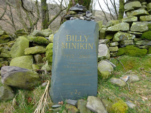
You will pass a memorial to Billy Milikin, and a good thought to take you higher:
Live each day as if it was your last, but dream like you will live forever
As the road rises, the views open out, and you might just have to stop to look at them.

Towards the top there is even a bench.

I say “the top”, but actually at “the top” the road then dives back part way down into the valley, before climbing steeply out the other side. Be careful going down – there are potholes and loose stones.
The route then joins the main road up the Whinlatter Visitor Centre.

Advantages of the route:
* Less traffic
* The route is shown on the Sustrans map and in The Ultimate Guide to the C2C
* A good challenge
* Wide views
Disadvantage of the route:
- a long steep haul
- more climbing overall because of the down-and-up after you think you have reached the top!
My preference: the map and guide book route, to keep you away from traffic – but it is a challenge!
